Operational river flood monitoring and forecasting system «Prostor» created under the Russian Science Foundation grant 17-11-01254 is currently being tested on the part of Northern Dvina river – from the city of Velikiy Ustyug to the city of Kotlas.
The principal key feature of the “Prostor” system is full automation of all stages of operation, including:
- loading of data from hydroposts (automated hydrological complexes) and meteorological data;
- generation of the contours and depths of flooding;
- publication of created contours on the GIS platform;
- identification of objects inside the flooded area;
- notification of interested persons.
Automation of processes and friendly simplified interface provides easy intuitive operation with the system even if the user is not a specialist in the field of hydrology, data processing, information and GIS technologies.
Every hour the system forms 24-hour forecast of flooded areas and depths for 24-48 hours ahead in the operational mode. The following operation scenario is also available: what happens if water levels at hydroposts reach the particular value.
The images from Russian satellite Resurs-P, European satellites Sentinel-1 and Sentinel-2 are constantly being loaded into the system – processed and published images give the opportunity to assess the accuracy of the modeling and quickly refine the parameters of models.
The potential users of the system are local administrations, regional hydrometeorological services, emergency services, services for population protection. Currently, they evaluate the test version of the system.
The system “Prostor” is focused, first of all, on the regional level of use where a highly detailed analysis of the available source data (such as digital elevation models, riverbed characteristics, permanent and temporary data from hydroposts, information about specific infrastructure in potentially flooded areas etc.) is necessary and requirements to the accuracy of simulation results used in the planning of protective and rescue measures are particularly high.
To work on the project, a team of specialists has been formed, combining advanced Russian scientific schools of both hydrological / hydrodynamic modeling and automatiс modeling, integrating heterogeneous information resources and creating modern information systems and services. This determines the uniqueness of the system and its truly interdisciplinary nature which has no analogues in Russia in this field of projects implementation.
At the previous stages of the research a successful testing of the system based on historical data was carried out. Currently, the most complex mechanisms for responding to hydrological phenomena (primarily associated with ice jams) are being worked out in operational mode.
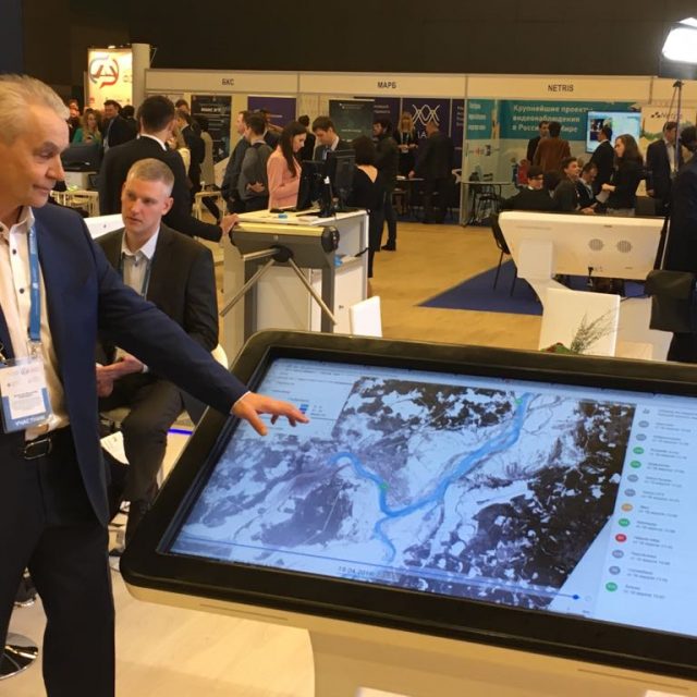
The system and its preliminary test results were presented at the St. Petersburg Digital Forum and aroused great interest of specialists.
The “Prostor” system is a completely Russian technology based on open source software. The following Russian software systems are applied for the system operation: «STREAM 2D» (Certificate of software registration № 2014612181), «ECOMAG» (Certificate of software registration № 2013610703) and also the systems developed at LITSAM – «UnisonPro» (Certificate of software registration № 2016660672) and «RegionView» (Certificate of software registration № 2016612635).


