Thematic processing of Earth remote sensing data
Project objective:
Part of the work aimed at creating a geographic information system (Center) for the Agro-industrial complex of the Leningrad region.
The main project objective was creation of thematic layers for digital maps of the selected Leningrad region districts on the basis of analysis and processing of remote sensing data acquired from air- and space vehicles.
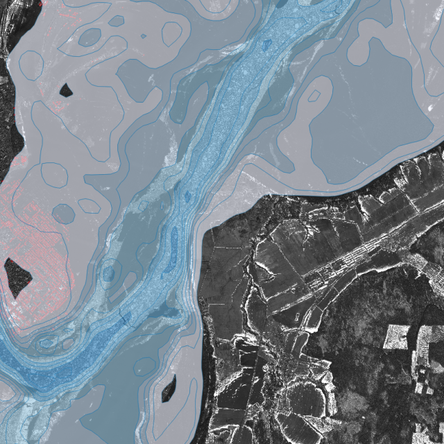
The main results of the project were the thematic layers of the Leningrad region agricultural lands for solving the following tasks:
- identification of unused land;
- clarification of the boundaries of land plots;
- assessment of the dynamics of lakes overgrowing;
- reflection of the forests status;
- reflection of the state of natural areas on the Leningrad region agricultural lands;
- reflection of protection zones around lakes;
- display of construction objects and engineering structures;
- display of pits;
- monitoring of agricultural lands of the Leningrad region, within the boundaries of the oil and gas facilities;
- analysis of the status of major construction projects from the ecology and fire safety points of view;
- analyzing the landfills location;
- displays data on the distribution of Hogweed Sosnowski;
- display of data on reclamation systems.
Duration:
2014
Project customer:
The project was implemented within the range of works carried out on request of the Committee for agriculture and fishery complex of the Leningrad region.
Project implementers:
SPIIRAS, Laboratory of Information Technologies in System Analysis and Modeling
Project head:
Chief Researcher, Doctor of Technical Sciences, Professor Viacheslav Zelentsov