Mochalov

InnoForestView project meeting in Finland

News

On August 27-28, 2019, InnoForestView project meeting was held in Punkaharju (Finland).

The meeting was attended by all project partners – representatives of  St. Petersburg Information and Analytical Centre, St. Petersburg State Forest Technical University, Natural Resources Institute Finland (Luke) and SPIIRAS. During the meeting, partners presented the current results of project activities.

LITSAM Chief researcher Viacheslav Zelentsov summarized SPIIRAS progress within the first 5 months of project implementation. The report included detailed information on performed activities according to the 2 main SPIIRAS working packages: «Satellite data thematic processing and interpretation» and «Innovative Information system implementation». Leading Programmer Victor Mochalov pointed out the importance of taking into account the formulated input data requirements for further efficient analysis of data from different sources. Senior Researcher Semyon Potryasaev presented main features of an information system prototype to be developed by SPIIRAS and the experience in intelligent information technologies development and application for solving practical tasks in different thematic areas.

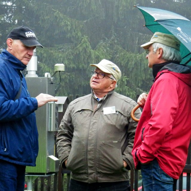
In addition, participants visited Luke’s field trial locations and were introduced to methodologies and drone technology used in the project research.

EMSS2018 in Budapest

News

On September 17-19, 2018, the 30th European Modeling & Simulation Symposium (EMSS2018) took place in Budapest (Hungary).

The symposium is traditionally one of the most important Modeling and Simulation event in Europe.

The topics of the symposium include applications and theoretical approaches of modeling and simulation in various research areas such as Industrial Engineering, Medicine, Business, Economy etc.

On section «Modeling & Simulation for Energy and Sustainable Development» Victor Mochalov presented the following report:

Hyperspectral data processing and adaptive modelling for the Natural Objects properties detection (Authors: Olga V. Grigoreva, Viktor F. Mochalov, Vjasheslav A. Zelentsov).

Software suite for creating downstream applications and thematic services on the base of remote sensing data processing and integrated modelling

Literature

Zelentsov, V., Potryasaev, S., Pimanov I., Mochalov V. Software suite for creating downstream applications and thematic services on the base of remote sensing data processing and integrated modelling // Proceedings of the international Geoscience and Remote Sensing Systems Symposium (IGARSS 2018), Valencia, Spain, pp 3477-3480 (2018). DOI: 10.1109/IGARSS.2018.8519066

IGARSS 2018

News

On July 22-27, 2018 the world’s largest forum on the topic of remote sensing International Geoscience and Remote Sensing Symposium (IGARSS 2018) took place in Valencia (Spain).

The forum is annually organized by IEEE Geoscience and Remote Sensing Society.

On section «Advances in Model-data Integration and Assimilation» LITSAM junior researcher Pimanov Ilya presented the following report:

Software suite for creating downstream applications and thematic services on the base of remote sensing data processing and integrated modelling (Authors: Zelentsov V.A., Potriasaev S.A., Pimanov I.Yu., Mochalov V.F.).

During the conference, a meeting was held with colleagues from the National Research Council of Italy and the questions of further cooperation were discussed.

Conference in Czech Republic

News

On 02-04 October, 2017 an international scientific conference titled “Quo vaditis agriculture, forestry and society under global change?“ took place in Velké Karlovice (Czech Republic). The conference was focused on the state of agriculture and forestry in conditions of global changes, and human dimension of global change impacts. The organizer of the conference was Global Change Research Institute CAS – CzechGlobe. The institute is investigating the ongoing global changes and their impact on the atmosphere, biosphere and human society through the use of the latest techniques and instrumentation.

In 2015 SPIIRAS (LITSAM) and CzechGlobe concluded a cooperation agreement. Within the framework of the agreement, the institutes conduct scientific research on integrated processing of aerospace and ground-based measurements data. The joint work is focused on social and environmental issues and based on hyperspectral satellite images from the Russian satellite system “Resurs-P” and the set of laboratory and experimental technical tools for the analysis of vegetation.

At the conference the representative of LITSAM Victor Mochalov presented the following report:

Zelentsov V., Potryasaev S., Pimanov I., Mochalov V. Intellectual Information Platform for thematic services creation with integrated use of ERS and in-situ data.

In the context of existing need of organizing the integrated processing of data from various technical means, the report attracted great interest.

Joint work of SPIIRAS and CzechGlobe will be continued.

I3M 2016

News

The 13rd International Multidisciplinary Modelling & Simulation Multiconference (I3M 2016) was held in Cyprus, Larnaca on September 26-28, 2016.

The staff of our laboratory made the following presentations:

  • Boris Sokolov, Semyon Potryasaev, Nikolay Mustafin, Sergey Nemykin, Vladimir Kalinin. Optimal structure coordination in supply chain (SC): principles, models, methods and algorithms for the sc structure dynamics control.
  • Boris Sokolov, Semyon Potryasaev, Karim Benyamna, Irina Sokolova, Dmitri Ivanov. Methodological and technical basis for interdisciplinary investigation in the field of cyber-physical- socio systems.
  • O. Grigorieva, O. Brovkina, V. Mochalov, Y. Akhtman, V. Zelentsov, S. Potryasaev, I. Kozyr, N.Belova. A complex model for forest ecosystem state assessment based on remote sensing data: case study in Baikalsky Nature Reserve.

The article on the Baikal Reserve was awarded the “Best Paper Award”.


Living planet Symposium 2016

News

Living Planet Symposium 2016 organized by the European space agency in cooperation with the Ministry of transport of the Czech Republic was held in Prague in the period from 9 to 13 May.

The main topic of the symposium was the discussion of the practical applications of Earth remote sensing data in solving the problems of the development of the economy, science and society.

The program of the symposium included more than 3300 reports. V.A. Zeletsov and V.F. Mochalov made two reports on the results of the testing of flood operative monitoring system and the use of hyperspectral data from «Resurs-P» in assessing the condition of crops and measuring the depths.

In addition, during the symposium meetings with representatives of foreign organizations took place and the prospects for cooperation within the framework of international programs and projects were discussed.